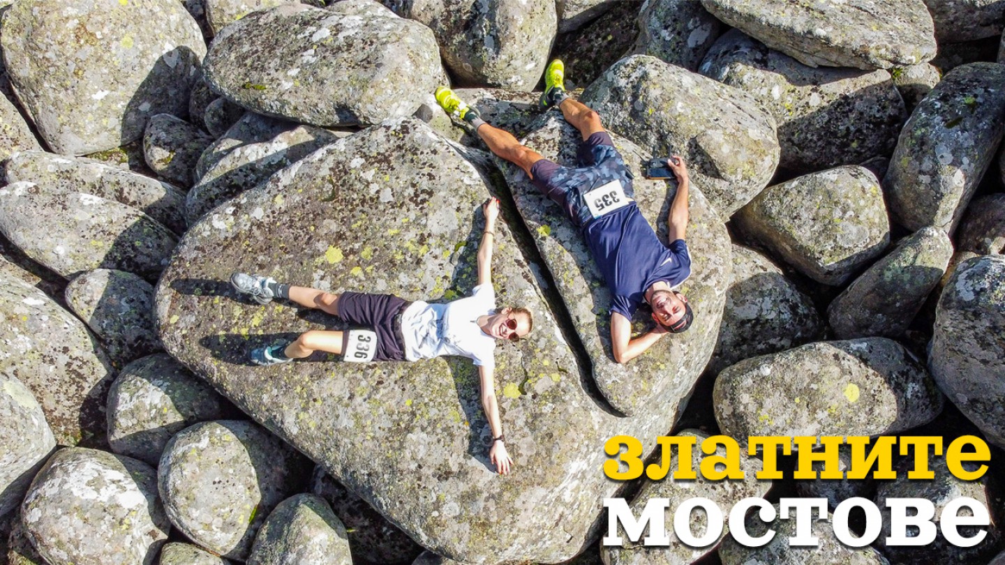
The Golden Bridges of Vitosha - one of the favorite places of Aleko Konstantinov
The Golden Bridges of Vitosha - one of the favorite places of Aleko Konstantinov
The Golden Bridges are probably the most visited place on Vitosha. More than 100 years ago, mountain lovers, with backpacks on their backs, came on their weekends on the small paths from Knyazhevo, Boyana and Vladaya to enjoy the beautiful nature. Today, Zlatni Mostove is connected to the capital by road, and there is also a bus.
The beauty of these stone rivers has been admired since Roman times, when the mineral springs around Serdica attracted visitors from distant parts of the Roman Empire. After the Liberation they became the subject of the first tourist events organized by Aleko Konstantinov in our country. They are now a favorite place for walks and recreation for thousands of residents and guests of the capital.
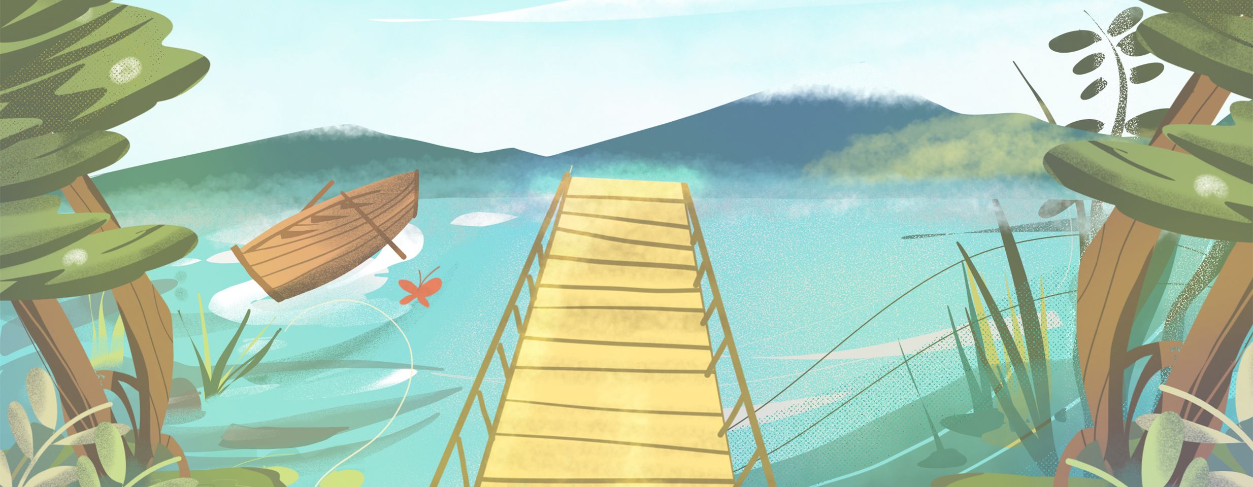
Most of the stones are covered with yellowish lichens, which, when warmed by the sun, acquire a golden color. This is one of the explanations for the name of the place. Others associate the name with the presence of gold-bearing sand in the river. The name "bridges" is given because the large and rounded stone blocks can not only cross the Vladayska River, but also a long walk along its bed. This place is one of the most attractive corners of Vitosha Nature Park. The area also impresses with its huge spruce trees, centuries-old beech and beautiful birches.
How do I get to the Golden Bridges?
Golden Bridges can be reached:- on a pedestrian path from Knyazhevo district (2 hours 30 minutes);
- from Vladaya quarter along the valley of the Vladayska river (1h. 30 min.);
- from Boyana by road (12 km)
- from Sofia by bus №63 (timetable here)
How did the "Golden Bridges" appear?
The geological phenomenon "Golden Bridges" is a stone river in the area of the same name on the northwestern slopes of Vitosha. It is located at an altitude of 1350-1500 m on the territory of the capital's Vladaya district. For a long time they were considered glacial moraines. However, after research it was found that these glaciations in Bulgaria cover a belt above 2300 m above sea level and thus are called stone rivers.
Apart from the Golden Bridges of Vitosha, other stone rivers can be seen in the areas of Yurushki Most and Vetrovala, around Selimitsa hut, north of Kamen Dyal Peak, below Cherni Vrah and in other places, with an approximate total area of about 10 km2.
Are there suitable routes / eco-trails nearby?
Many tourist routes start from the Golden Bridges area and you have an extremely wide choice.
One of the route choices can be to the Kumata hut. It travels for nearly an hour at a moderate pace. The ascent is about 375 meters and the markings are blue in color.
Here is also one of the most frequently used starting points to Cherni Vrah (the distance is 8.5 km long, which is covered in about 2 hours and 30 minutes, passing through the hut "Kumata", Konyarnika and Samara shelter). The total ascent is about 566 meters. After Kumata hut, follow the winter stake marking to the peak of Vitosha.
One of the most beautiful destinations is Kopitoto peak - famous for its panoramic view over Sofia. The transition there takes about an hour and is definitely worth a walk.
For more routes and detailed information you can visit the Vitosha Park page. See routes here
Hey, don't you think your friends would love to see this story? Share it with them and help my blog. Love ya, buddy


Leave a comment