Grado Peak - a wild escape from the big city
Grado Peak - a wild escape from the big city
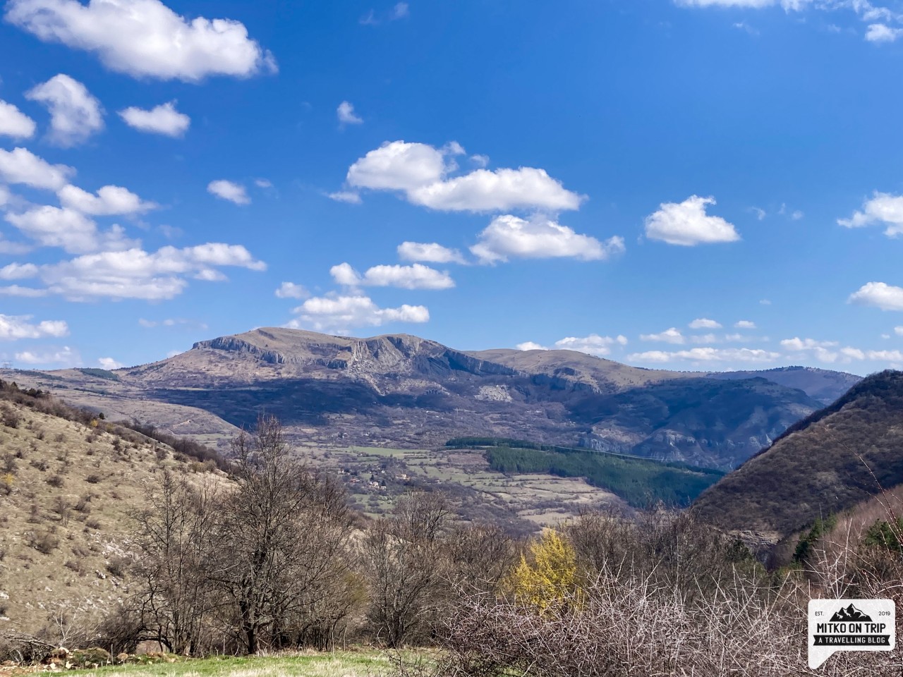
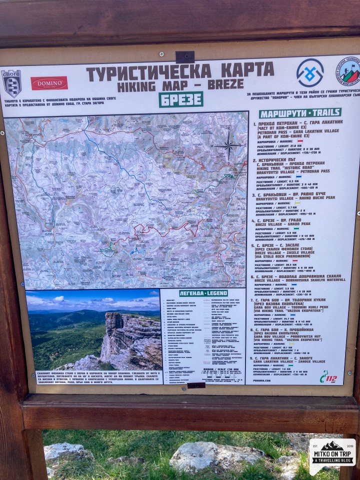
Grado peak is located in Ponor mountain. With its 1082 meters, it is definitely not the highest peak in the mountain, but the path to it will fascinate and captivate you. It is located near the village of Breze, which is a little off the road Sofia - Montana, about 50 km from Sofia. The path to the top is 5.5 km long and takes an hour and a half at a normal pace. The peak is not very clearly defined, but from there you can see a great view of the village of Breze, the village of Dobravitsa and the rock phenomenon Stolo, which is one of the symbols of Ponor.
How do you get to Mount Grado?
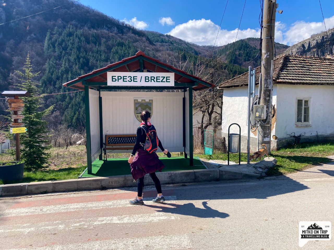
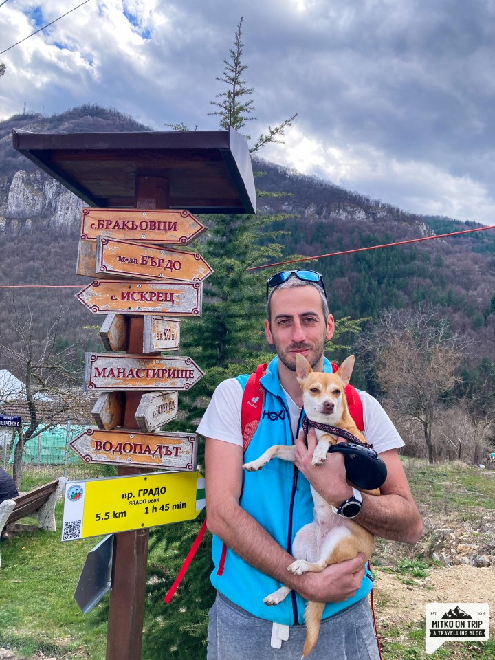
We started our walk to Mount Grado in the center of the village of Breze. There were only a few parking spots, but we managed to find a spot. Right there next to the children's corner is the information board, which will be the beginning of our route. Link to google coordinates here.
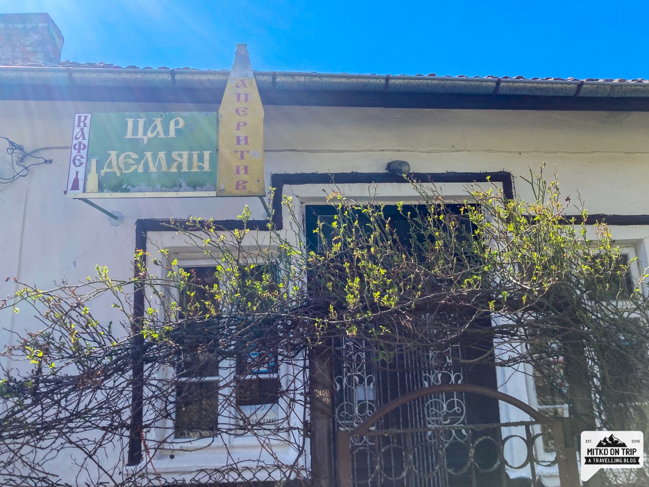
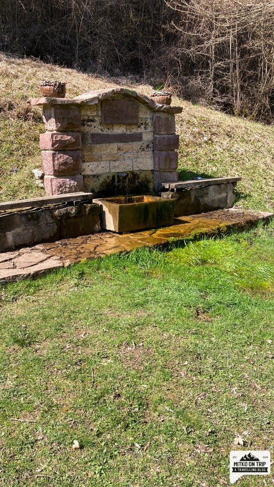
From there, follow the green marking, which goes to the right and goes down past "cafe tsar Demyan". You cross the Brezenska River and find yourself next to a beautiful fountain. From there, the trail takes you left and right along quaint forest paths to the top.
Download GPS track
How long does it take?
The time you need to climb is about 1 hour. and 30 minutes - 2 hours. In total, it took us about 4 hours to get on, get off, take a short break and take pictures.If you travel by car from Sofia, the journey time is about 1 hour in one direction.
Is the trail steep? Are there scary sections?
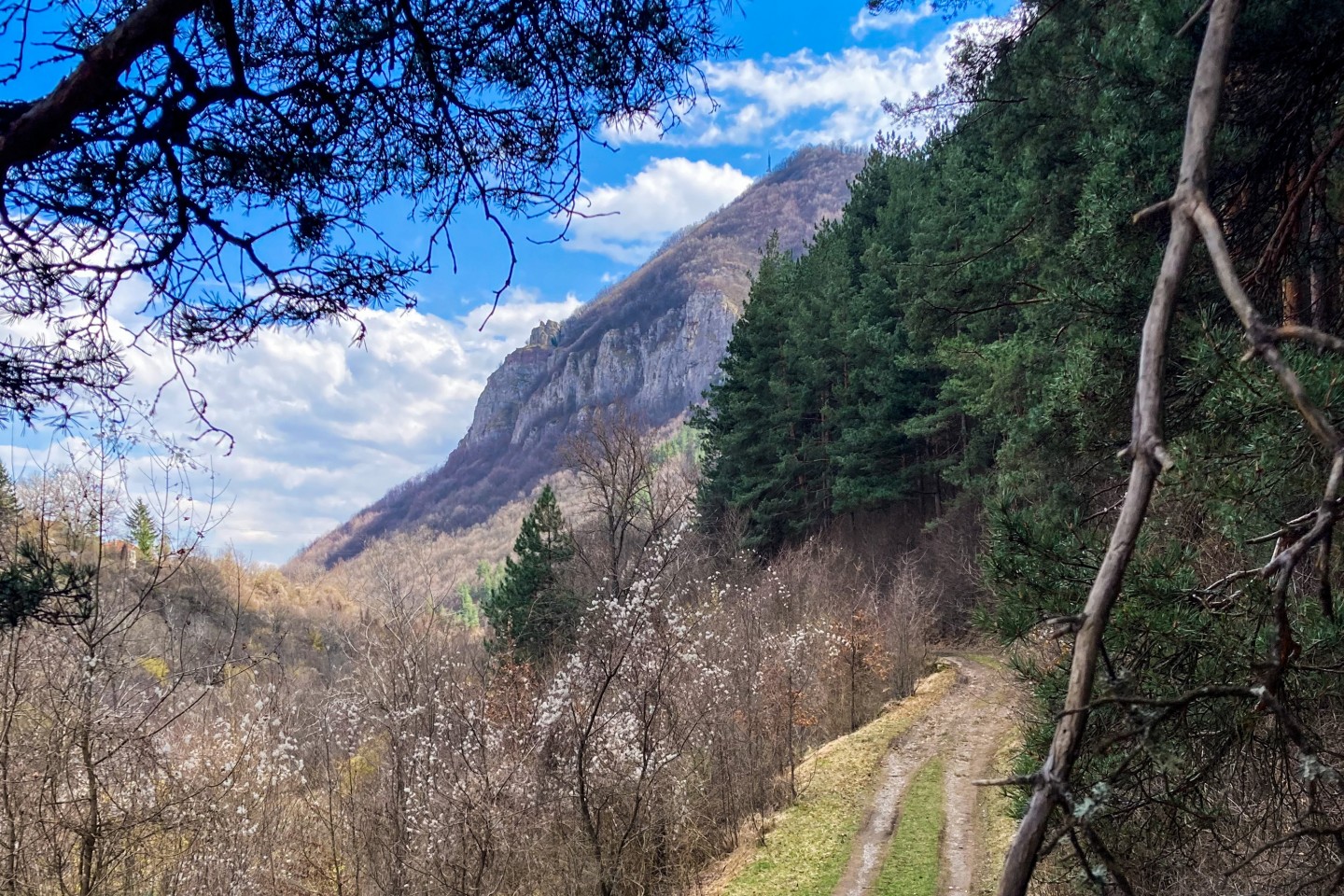
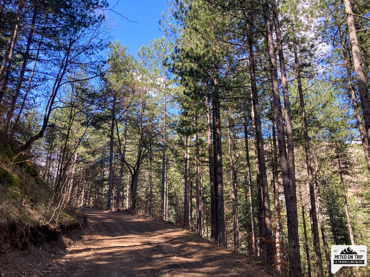
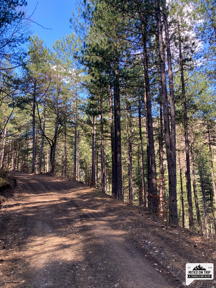
The trail to the top is very pleasant and there are no steep or scary sections. It is curious here that there are alternating ascents and descents on the way to the top. The trail winds through the forest most of the time, and the only thing more troubling is the view from the top itself.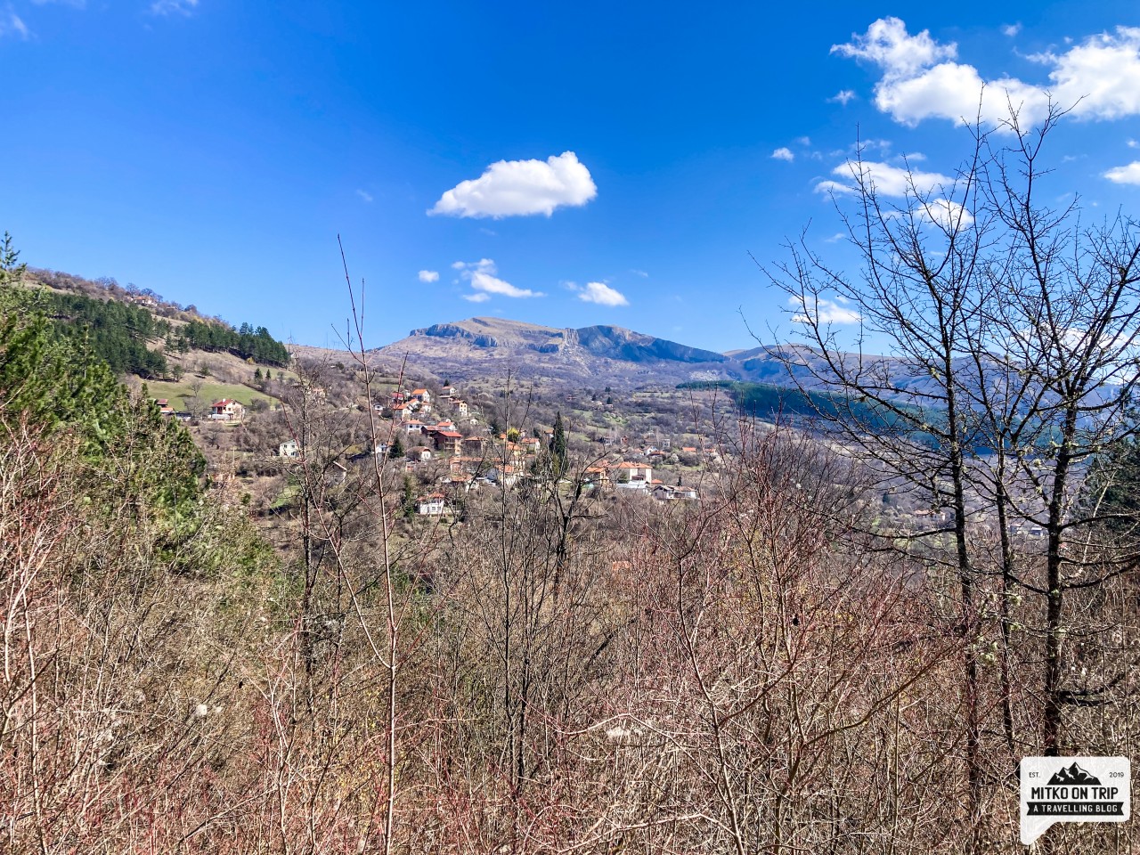
Can you tell me more about the route to the top?
The trail runs through the forest for the most part, and a few times you briefly appear in a meadow and you can enjoy wonderful views. I recommend you pour yourself water at the tap at the beginning because there are no water sources after that. Already at the beginning above the fountain (on the left) there is a table with benches where you can stop for a picnic, and a little further up there is also a built gazebo with a roof for rest or shelter in rainy weather.The trail is lovely to visit in all seasons (in my opinion) and a good escape from the big city. It is not very popular, but on the other hand, the marking is excellent.
Is the trail suitable for small children?
Yes, I would recommend visiting this trail with your kids and/or your dog. The path is pleasant and can be run, but the final point at the very top must be approached with care.Is there a convenient picnic spot nearby?
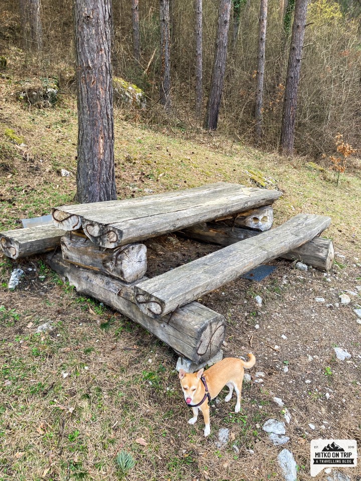
The table with benches above the fountain and the gazebo in the first kilometer of the trail are the two built-in rest areas. In case you bring a picnic blanket, you can lie down on the second half of the trail and enjoy solitude and peace.
When is the best time to visit?
We visited the trail on a sunny day in early spring (March) and it was a very pleasant walk. I would happily visit in the summer and fall as well, but maybe think about sunscreen. In the winter I would bet on good gear. In general, it is suitable for a year-round visit, but be sure to bring a good mood with you.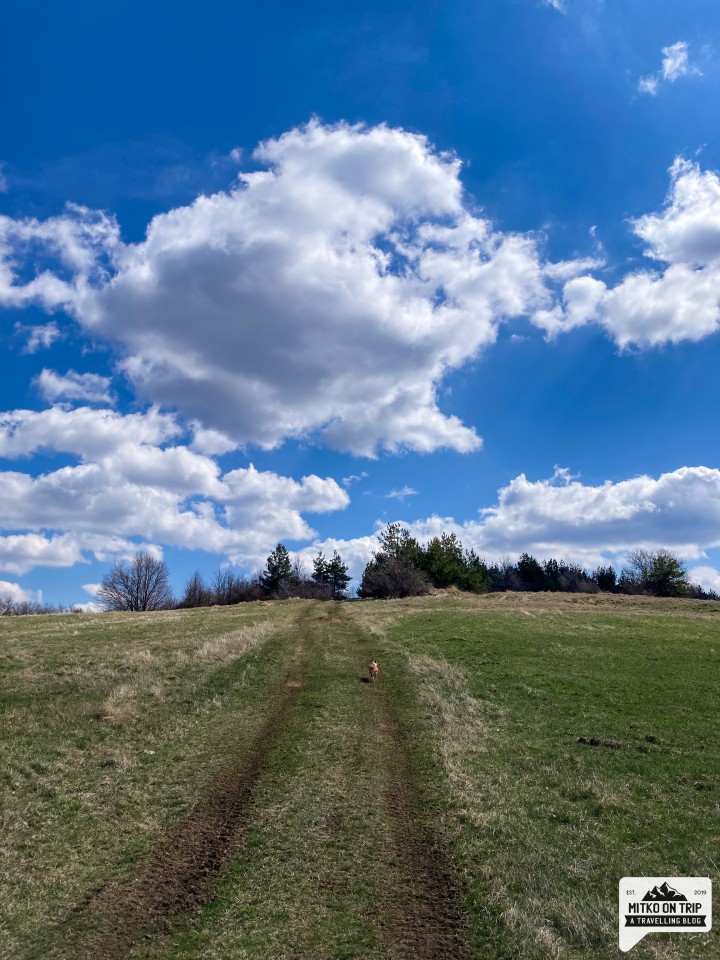
Can I bring my dog?
But of course! The path is quite wide and there are not many tourists, which can be a paradise for your dog. Lots of scents, a good workout and freedom to run will make him as happy as you will be at the end of your walk.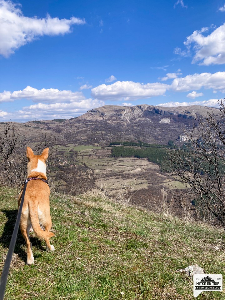
What's interesting nearby?
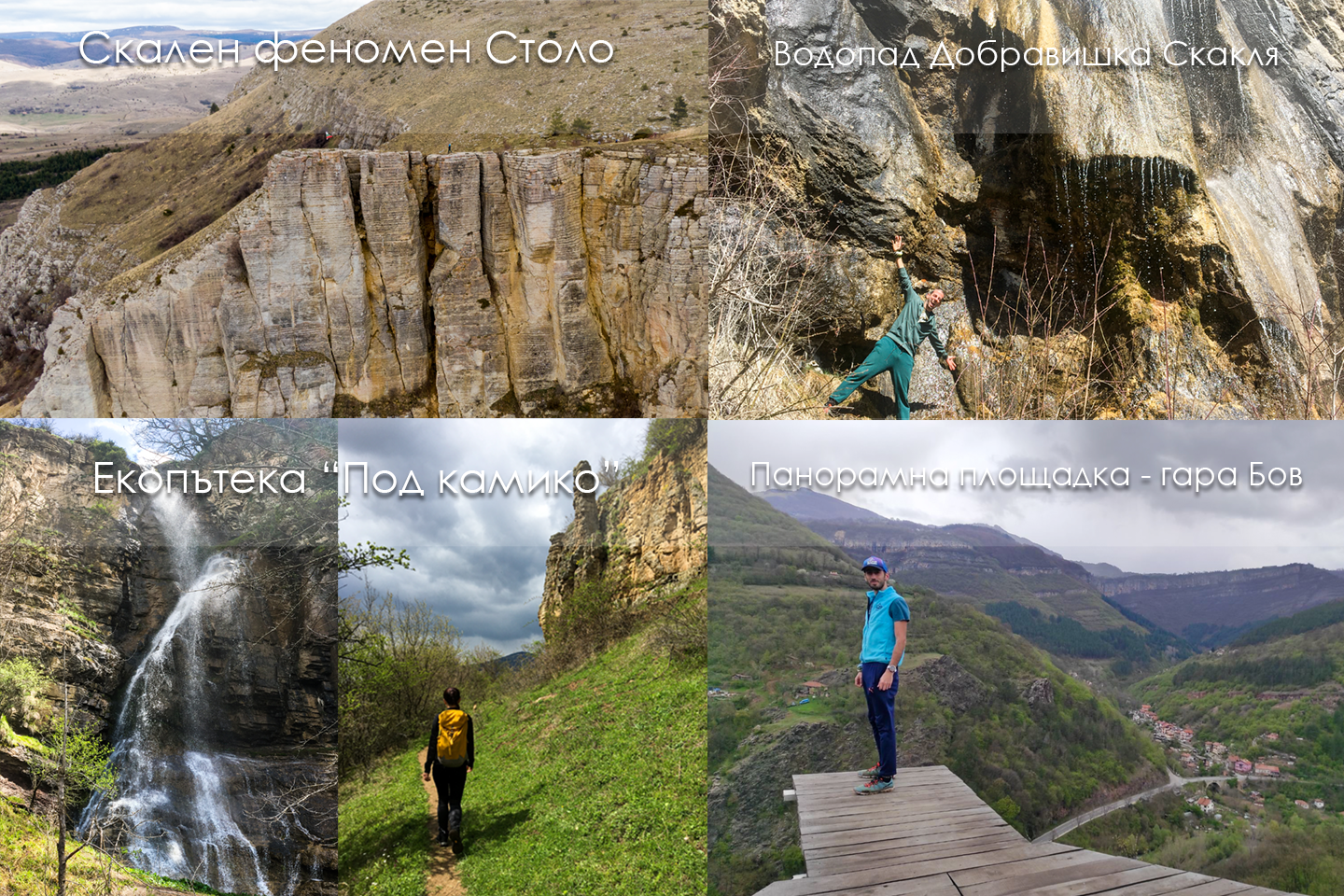
In the immediate vicinity is the wonderful Dobravishka Skaklya waterfall. On the opposite hill is the Stolo rock phenomenon. These two sites are definitely suitable for a combination in one day.You can also visit the "Under Kamiko" eco-path near Bov station, the panoramic platform near Bov station, the Vazova eco-path and Skaklya waterfall.
About my adventure
We have been wanting to visit Mount Grado for some time. Willy told me he wanted to visit him, and I agreed without hesitation. Unfortunately, we missed him several times due to urgent commitments, car problems and others, but in the end we managed to reach the starting point - namely the center, not the village of Breze.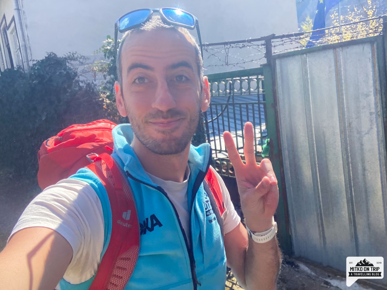
We left the car in a small square with only a few parking spaces and headed for the beautifully painted stop and route sign in the area. In the distance behind the stop we casually look at our goal for the day - Mount Grado. From our position, it looks very imposing and proudly towers over the village. Later, however, we understand that the walk to it is quite pleasant, but one at a time.
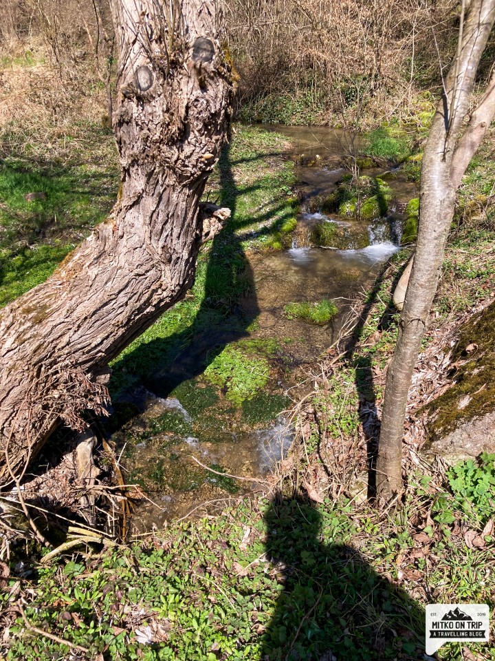
At first we are a little confused as to exactly where to start on the trail, but we continue down an alley to the right of the stop that runs down to the river. We pass Tsar Demyan Cafe, which turns out to be the right choice and I recommend you use it as a reference point. The path descends between the houses and leads you to a small river with a beautiful fountain and barbecue. It's definitely a nice place, but it's too early for us to rest and we're leaving it as an option for the return trip.
After crossing the river, we are transported to a wonderful forest world. The trail, which is actually the size (and perhaps the purpose) of a highway, is very easy and pleasant. Before long, we enter a pine forest, and the road twists and turns and reveals different views before us. We see a panorama towards the village of Breze, and in the distance the rock phenomenon of Stolo. Shortly after, we see rock massifs, and after them we reach a large meadow with a view in different directions.
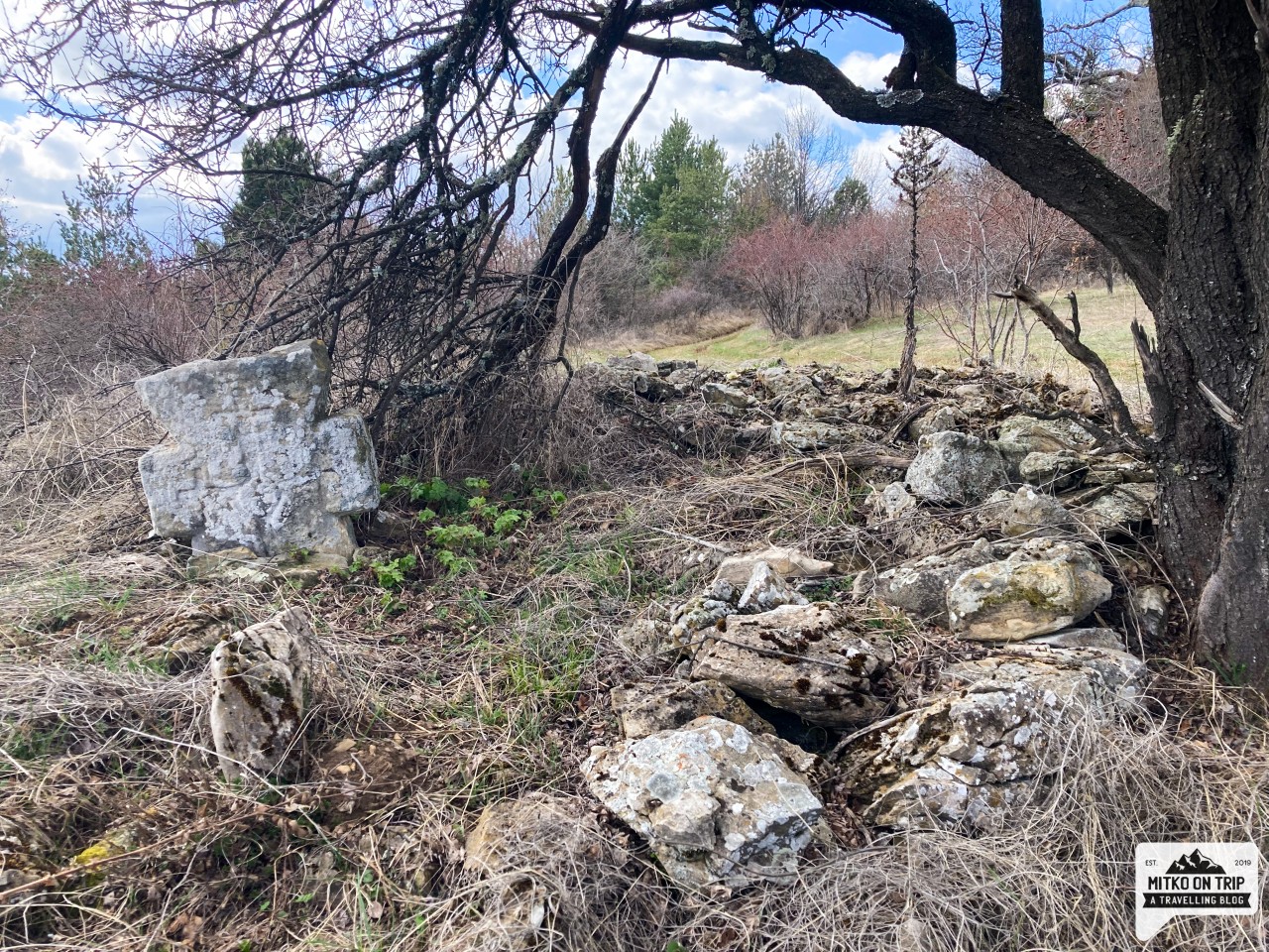
After this meadow, the landscape changes a little from the pine forest to shrubs and broad-leaved trees. The trail runs most of the time in the shade under the trees and is quite nice and cool. At one point we notice an interesting tree house and also a stone cross. (I'll leave you to discover where they are.. )
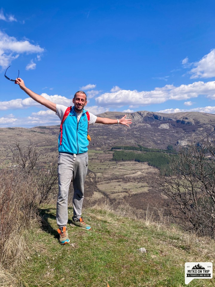
At one point we reached a fork in the road and the first one where we didn't find any markings for TD Ponoria. It turned out, in fact, that both paths lead to the top. ( We started on the right, and then tried the left. ) After a short climb, we reach our goal - Mount Grado. To be honest, I expected there to be some point or elevation, but the wonderful panorama towards the village of Breze and the Ponor mountain distracted me from any such thoughts.
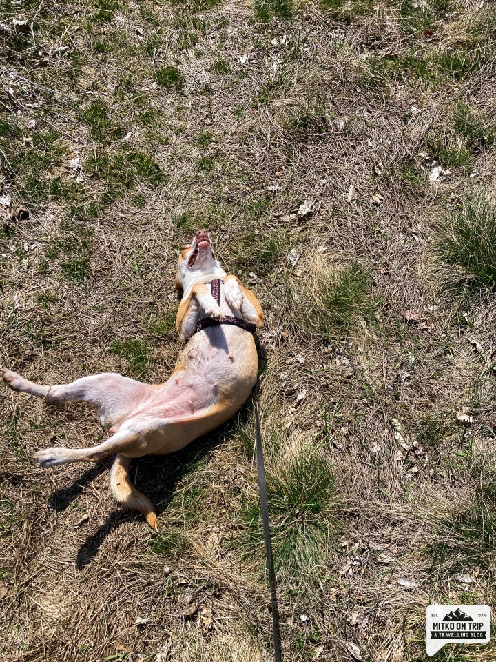
A short break for smiles and games with our dog Jerry and we head back down the trail. It turns out that a gentle back drop is the perfect way for your dog to chase a ball without having to constantly throw it. On the way back we have fun and enjoy the beautiful views as we imperceptibly reach the bottom of the trail and stop for a rest in a small gazebo.
Before long we are climbing gently towards the village and our day of adventure is coming to an end. Plans are already being made in the car for further destinations, and Mount Ponor definitely has its place in them. See you soon!
Special thanks to the Ponoria Association, which took care of the wonderful markings and the nice route.
Hey, don't you think your friends would love to see this story? Share it with them and help my blog. Love ya, buddy


Leave a comment